USEFUL INFORMATION ABOUT ALL CITIES, VILLAGES AND RESORTS IN BULGARIA
Settlement:
Town/Village:
- village of Ahryansko
- village of Albanci
- village of Apriltsi
- town of Ardino
- village of Austa
- village of Avramovo
- village of Avren
- village of Ayrovo
- village of Bagra
- village of Bagrilci
- village of Bagryanka
- village of Bakalite
- village of Balabanovo
- village of Baraci
- village of Barzeya
- village of Bashevo
- village of Bashtino
- village of Bedrovo
- village of Beli plast
- village of Beli vir
- village of Benkovski
- village of Bezvodno
- village of Bivolyane
- village of Blagun
- village of Blenika
- village of Bogatino
- village of Bolyarci
- village of Borovica
- village of Boynik
- village of Boyno
- village of Bozhak
- village of Bozhurci
- village of Brezen
- village of Brosh
- village of Bryagovec
- village of Buk
- village of Byal izvor
- village of Byala polyana
- village of Byalka
- village of Carevec
- village of Carkvica
- village of Chakalarovo
- village of Chakalci
- village of Chal
- village of Chavka
- village of Chereshica
- village of Cherna niva
- village of Cherna skala
- village of Chernichevo
- village of Chernoochene
- village of Chernooki
- village of Chichevo
- village of Chiflik
- village of Chilik
- village of Chobanka
- village of Chorbadzhiysko
- village of Chubrika
- village of Chukovo
- village of Daskalovo
- village of Dazhdino
- village of Dazhdovnica
- village of Dazhdovnik
- village of Dedec
- village of Delvino
- village of Devesilovo
- village of Devinci
- village of Doborsko
- village of Dobrinci
- village of Dobromirci
- village of Dolishte
- village of Dolna krepost
- village of Dolna kula
- village of Dolni yuruci
- village of Dolno kapinovo
- village of Dolno prahovo
- village of Domishte
- village of Draganovo
- village of Drangovo
- village of Druzhinci
- village of Dryanova glava
- village of Dushinkovo
- village of Dyadovci
- village of Dyadovsko
- village of Dyulica
- village of Dzhanka
- town of Dzhebel
- village of Dzhelepsko
- village of Dzherovo
- village of Edrino
- village of Egrek
- village of Enchec
- village of Enyovche
- village of Erovete
- village of Fotinovo
- village of Gabrovo
- village of Garbishte
- village of Gaskovo
- village of General-Geshevo
- village of Glavatarci
- village of Gluhar
- village of Gnyazdovo
- village of Golyam devesil
- village of Golyama bara
- village of Golyama chinka
- village of Golyamo kamenyane
- village of Gorna krepost
- village of Gorna kula
- village of Gorni yuruci
- village of Gorno kapinovo
- village of Gorno kirkovo
- village of Gorno prahovo
- village of Gorski izvor
- village of Grivka
- village of Grivyak
- village of Gruevo
- village of Guliya
- village of Guliyka
- village of Hadzhiysko
- village of Hisar
- village of Hrastovo
- village of Hromica
- village of Iliysko
- village of Ivanci
- village of Kableshkovo
- village of Kachulka
- village of Kaklica
- village of Kalinka
- village of Kaloyanci
- village of Kamenka
- village of Kandilka
- village of Karchovsko
- village of Kayaloba
- village of Kirkovo
- village of Kitna
- village of Kitnica
- village of Kobilyane
- village of Kokiche
- village of Komuniga
- village of Konche
- village of Konevo
- village of Kontil
- village of Kos
- village of Kostino
- village of Kotlari
- village of Kovil
- village of Kozhuharci
- village of Kozlevo
- village of Kran
- village of Krasino
- village of Krayno selo
- village of Kremen
- village of Krilatica
- village of Krin
- town of Krumovgrad
- village of Krushevska
- village of Krushka
- village of Kukuryak
- village of Kyosevo
- village of Lale
- village of Lebed
- village of Lenishte
- village of Leshtarka
- village of Limec
- village of Lisicite
- village of Lozengradci
- village of Lulichka
- village of Lyaskovo
- village of Lyulyakovo
- village of Madrec
- village of Maglene
- village of Makedonci
- village of Malak devesil
- village of Malka chinka
- village of Malko kamenyane
- village of Malkoch
- village of Manchevo
- village of Medevci
- village of Metlichina
- village of Metlichka
- village of Metlika
- village of Miladinovo
- village of Mishevsko
- village of Mlechino
- village of Mogilyane
- town of Momchilgrad
- village of Moryanci
- village of Most
- village of Murgovo
- village of Nane
- village of Nanovica
- village of Nenkovo
- village of Neofit-bozvelievo
- village of Nevestino
- village of Ohlyuvec
- village of Opalchensko
- village of Oreshari
- village of Oreshnica
- village of Orlica
- village of Ostrovec
- village of Ostrovica
- village of Ovchari
- village of Ovchevo
- village of Padarci
- village of Padina
- village of Panchevo
- village of Panichkovo
- village of Paprat
- village of Parvenci
- village of Parvica
- village of Pashinci
- village of Patica
- village of Pazarci
- village of Pchelarovo
- village of Pelin
- village of Penyovo
- village of Pepelishte
- village of Perperek
- village of Perunika
- village of Petelovo
- village of Petlino
- village of Plazishte
- village of Plovka
- village of Podkova
- village of Podrumche
- village of Polkovnik-zhelyazovo
- village of Polyanec
- village of Postnik
- village of Potocharka
- village of Potochnica
- village of Povet
- village of Pravdolyub
- village of Preseka
- village of Pripek
- village of Progres
- village of Propast
- village of Pryaporec
- village of Ptichar
- village of Ralica
- village of Ralichevo
- village of Rani list
- village of Rastnik
- village of Raven
- village of Rezbarci
- village of Ribino
- village of Ridino
- village of Rogach
- village of Rudina
- village of Rusalsko
- village of Samodiva
- village of Samokitka
- village of Samovila
- village of Sarnak
- village of Sbor
- village of Sedefche
- village of Sedlari
- village of Sedlovina
- village of Sekirka
- village of Sestrinsko
- village of Shiroko pole
- village of Shopci
- village of Shterna
- village of Shumnatica
- village of Sindelci
- village of Siniger
- village of Sipec
- village of Sipey
- village of Skalak
- village of Skalina
- village of Skalishte
- village of Skalna glava
- village of Sladkodum
- village of Slanchogled
- village of Slivarka
- village of Sofiyci
- village of Sokolino
- village of Sokolite
- village of Sokolyane
- village of Solishte
- village of Spoluka
- village of Sredinka
- village of Srednevo
- village of Stareyshino
- village of Stari chal
- village of Starovo
- village of Stomanci
- village of Strandzhevo
- village of Strazhec
- village of Stremci
- village of Stremovo
- village of Strizhba
- village of Studen kladenec
- village of Suhovo
- village of Svatbare
- village of Svetlen
- village of Svetulka
- village of Svoboda
- village of Svobodinovo
- village of Tarnoslivka
- village of Tatul
- village of Tihomir
- village of Tintyava
- village of Tokachka
- village of Topolka
- village of Tri mogili
- village of Ustren
- village of Valchanka
- village of Varben
- village of Varbenci
- village of Varhari
- village of Veleshani
- village of Velikdenche
- village of Vishegrad
- village of Visoka polyana
- village of Vodach
- village of Vodenicharsko
- village of Volovarci
- village of Vozhdovo
- village of Vransko
- village of Vrelo
- village of Yabalcheni
- village of Yabalkovec
- village of Yastreb
- village of Yonchovo
- village of Zagorski
- village of Zavoya
- village of Zdravchec
- village of Zelenikovo
- village of Zhaltusha
- village of Zheladovo
- village of Zheleznik
- village of Zherka
- village of Zhinzifovo
- village of Zhitnica
- village of Zimzelen
- village of Zlatolist
- village of Zvanarka
- village of Zvezdel
- village of Zvezdelina
- village of Zvezden
- village of Zvinica
The village of Pripek
See it on the map Bulgarian properties in Kardzhali Region - Pripek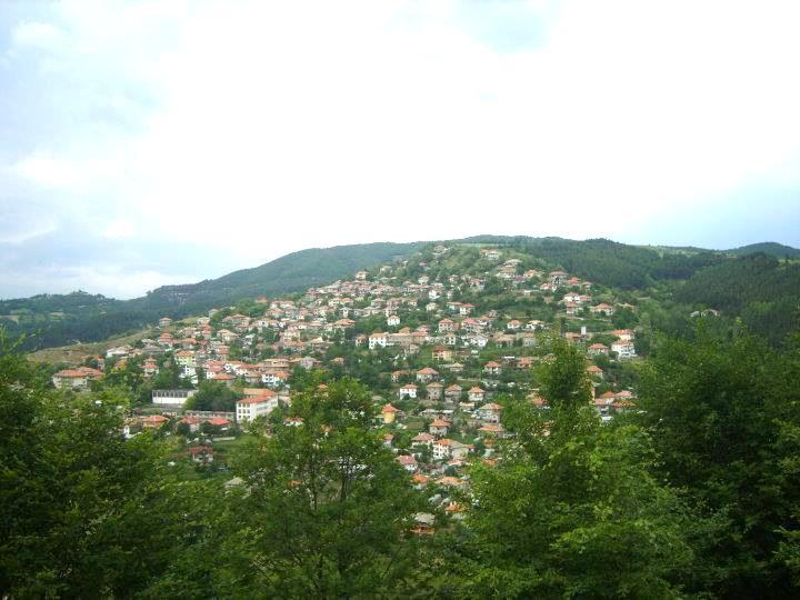
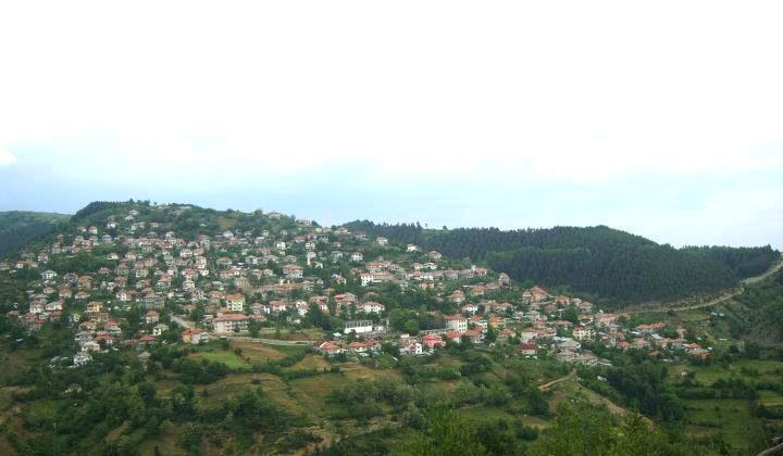
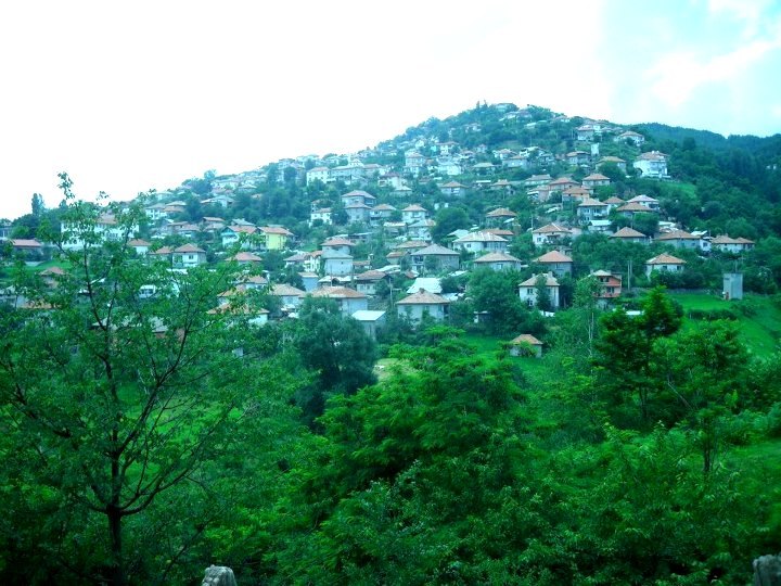
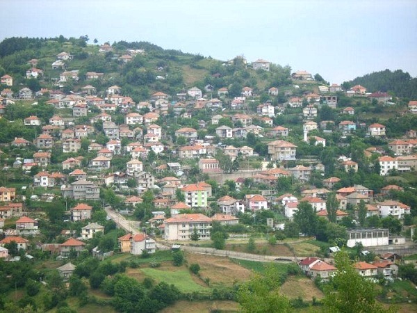
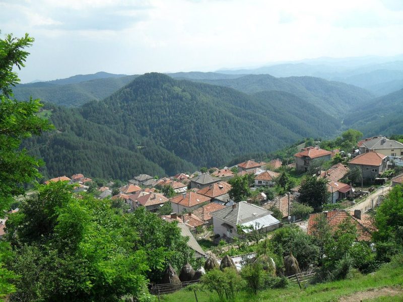
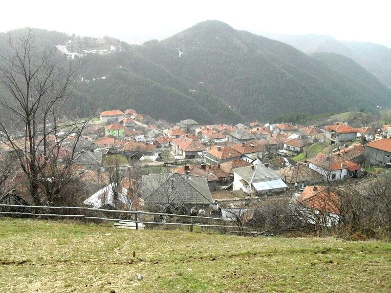
Pripek is a village in Southern Bulgaria. It is part of the municipality of Dzhebel, Kardzhali region.
In Bulgaria there are two more villages with the same name - in the municipality of Ruen, Burgas Region and in the municipality of Aksakovo, Varna Region.
It is located at 15 km south-west of Dzhebel, 37 km in the same direction of Kardzhali, 33 km south of Momchilgrad and about 277 km south-east of the capital Sofia city.
The village is located on the border between the Rhodopes and the Eastern Rhodopes, on the south-eastren slopes of Zhalti rid at an altitude of 820 m. Pripek is very close to the border of Kardzhali Region and Smolyan Region. The climate is mountainous with Mediterranean influence. Winters are soft and snowy, summers are cold and wet and the autumns are long and hot.
Here live about 830 people.
The village has a very good infrastructure, the main streets are paved and lighted, there are water supply and electricity systems. All mobile operators have coverage. Regular bus transport connects it to the municipal center and the neighbouring villages.
There are a functioning town hall, community center, primary and secondary schools as well as a kindergarten here. In Pripek operate one GP and one dentist. General hospitals you will find in Momchilgrad and in Kardzhali.
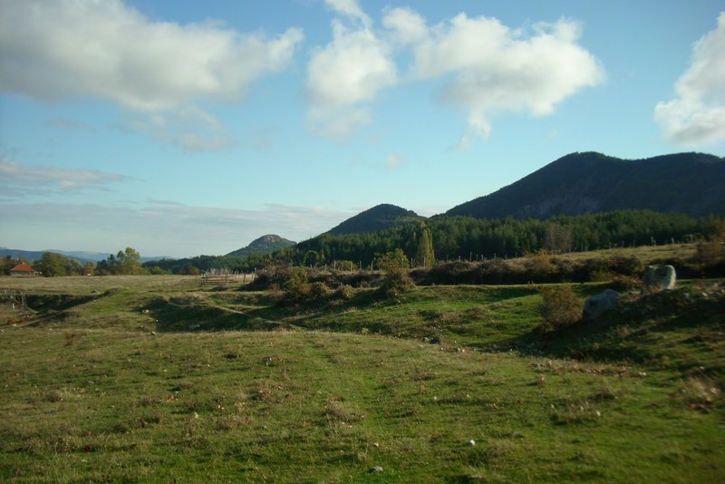
Landmarks and tourism
Each year in May the traditional fair of the village is held here. Lots of folklore groups from the surrounding villages take part in the fest.
Only 3 km in the north-east is situated the Medieval fortress Ustra. It was built in the X century - supposedly during the reign of Constantine VII Porphyrogenitus - 913-959. The fort had three protective towers, which had three floors and internal staircases (some of which are still preserved). Many metal objects, pottery and copper coins were found during archeological excavations of the site.
At the foot of the Ustra fort are located the famous Swan Lakes, formed as a result of earthquakes. They are natural landmark with significant landscape value. Natural wild water lilies and other rare plant species grow in the lakes.
10 km in the same direction, in the close proximity of the village of Vodenicharsko, can be visited the Mal Asra fortress. It is located on a not very high rocky and needlepoint peak. It was built in the VI century and later, in the XI century was additionally built.
Again in the village of Vodenicharsko is located the interesting geological phenomenon the Broken Mountain. It represents a tall, interrupted in the middle hill on the road to Vodenicharsko, shortly before the "Chamlak" protected area. The left side of the hill is shifted and sank compared to the right, at a distance of about 600 m. The difference in the altitude is about 80 m. The break is the result of tectonic shift.
Remains of the "Asar" fort can be seen about 16 km north of Pripek, near the village of Zhaltika.
Sources: http://www.dzhebelbg.com, http://bg.wikipedia.org, http://bg.guide-bulgaria.com
Photos: Internet
